 Advances in Engineering Advances in Engineering features breaking research judged by Advances in Engineering advisory team to be of key importance in the Engineering field. Papers are selected from over 10,000 published each week from most peer reviewed journals.

Significance
Wildland fire is a non-structure fire that occurs in vegetation or natural fuels. The frequency of such fires has increased in recent times as a consequent of dryer and warmer climate. Wildfires if left uncontrolled can destroy large areas of vegetation stripping the soil of its protective cover. Technological advances have enabled remote measurements of almost every event that happen. Consequently, the detection and analysis of objects in a frame or a sequence of frames (video) can be used to solve a number of problems in various fields, including the field of fire behavior and risk. During wildland and structural fires, a large number of burning and glowing firebrands are generated and then transported by the convection column of a fire front and by the wind.
An understanding of how the firebrands can ignite the surrounding fuels is an important consideration in mitigating fire propagation in communities. Unfortunately, a quantitative understanding of the short distance spotting dynamics, namely the firebrand density distribution within a distance from the fire front and how distinct fires coalesce in a highly turbulent environment, is still lacking.
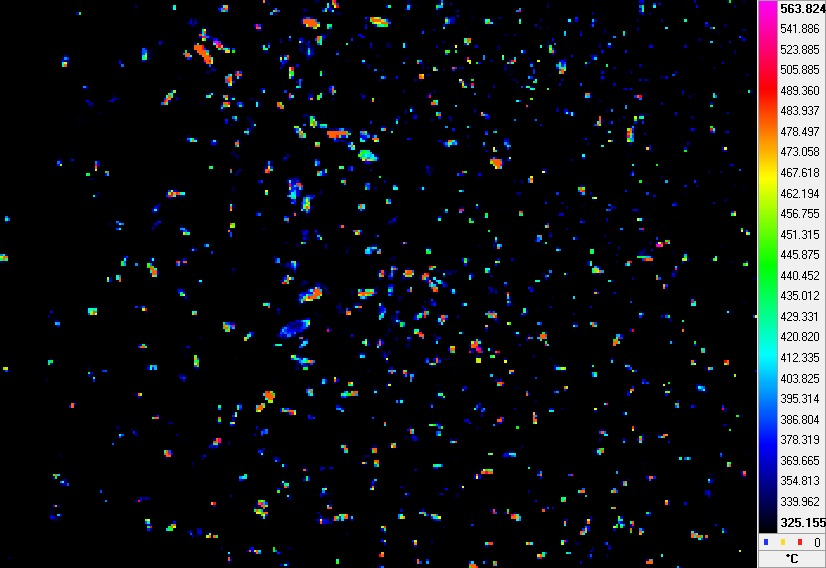
In a recent publication in Fire Technology, Dr. Alexander Filkov from the School of Ecosystem and Forest Sciences at University of Melbourne, Australia together with Mr. Sergey Prohanov at the National Research Tomsk State University developed a custom software that would facilitate detect the location and the number of flying firebrands in a thermal image. As such, on would be able to determine the temperature and size of each fire band. Their study was motivated by the fact that there are no off-the-shelf approaches that provide a solution to the stated problem.
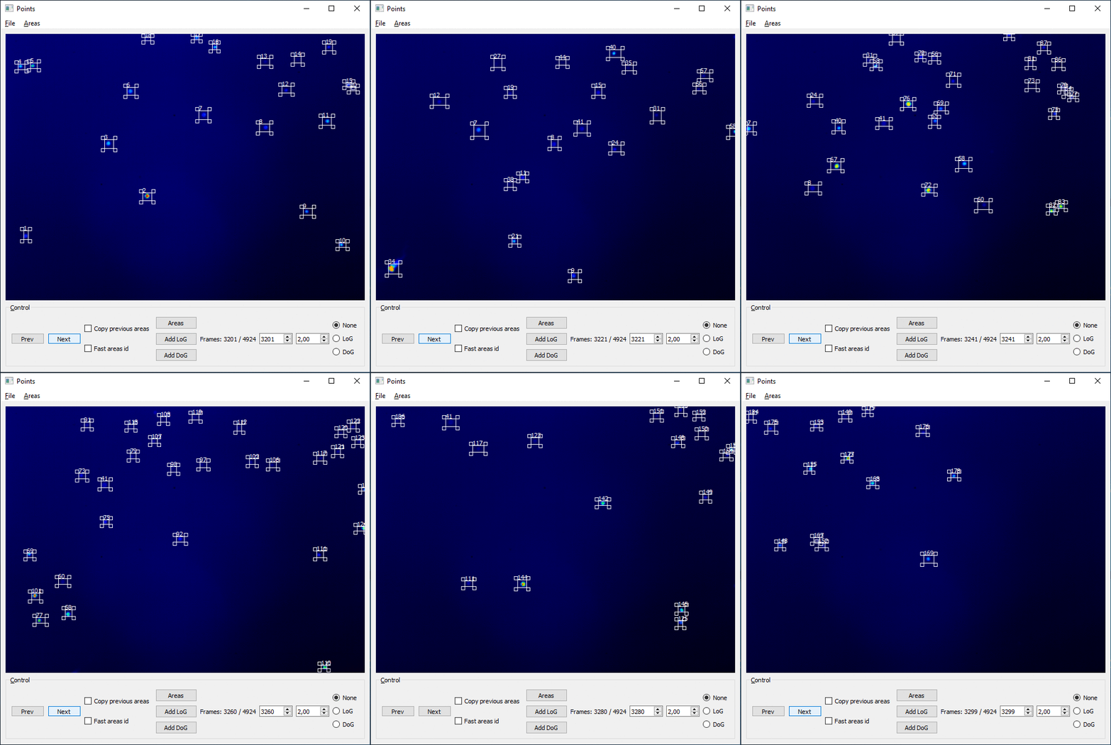
The software developed by Alexander Filkov and Sergey Prohanov of two modules: the detector and the tracker. Operation of the modules was such that the detector determined the location of the firebrands in the frame and their characteristics, and the tracker compared the firebrand in different frames and track it through them. For this purpose, equipment such as thermal imager FLIR A325, FLIR ThermaCAM Researcher, computer vision library OpenCV, custom developed filters, document-oriented database management system MongoDB,– among others were used.
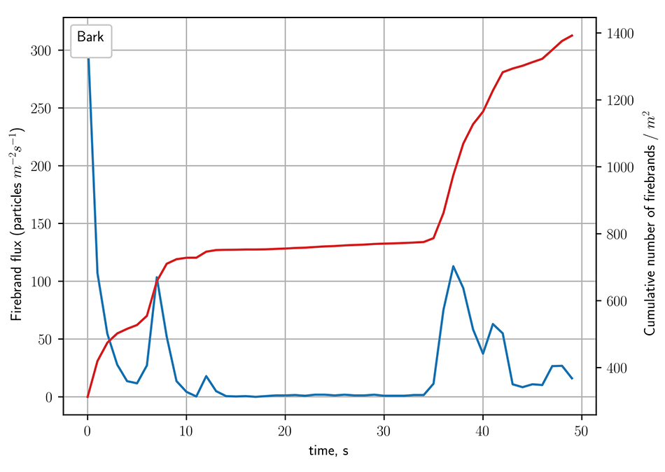
The authors pointed out that a comparison of the calculated results with the data obtained by the independent experts and experimental data showed that the maximum relative error did not exceed 12% for the low and medium number of firebrands in the frame (less than 30). Additionally, the software was seen to agree well with experimental observations. The authors revealed that even occasional crowning increases firebrand flux from 3 to 10 times compared to surface fire. They also found out that the change of fireline intensity (180–12,590 kW m-1) modifies significantly 2D firebrand flux for small firebrands (<2 cm).
In summary, a special software was developed to detect the location of flying firebrands, determine the temperatures and sizes, and calculate the number of the firebrands. In an interview with Advances in Engineering, Dr. Alexander Filkov – the correspondent researcher, highlighted that the results obtained from their study could support the development of theoretical models for the firebrand transport and fuel bed ignition during wildland fires in the future. He further said that the software had potential to be used for structural fires, as they produce firebrands similar to wildland fires.

Reference
Alexander Filkov, Sergey Prohanov. Particle Tracking and Detection Software for Firebrands Characterization in Wildland Fires. Fire Technology 2019 Volume 55, Issue 3, page 817–836.
Go To Fire Technology